|
Satellites are taking pictures of Earth everyday so scientists can watch how the landscape of Earth's surface changes over time. Are you curious to see what it looks like? 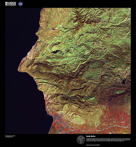 The tendency to recognize human faces in things that are not human is common. Can you see the eye, nose, and mouth in this satellite image of Morocco? 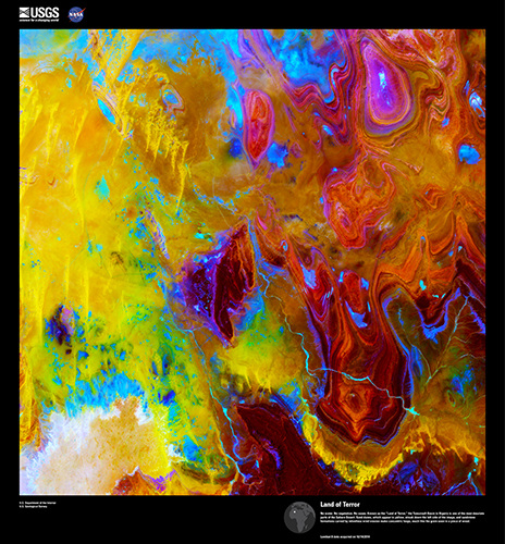 No water. No vegetation. No oases. Known as the "Land of Terror," the Tanezrouft Basin in Algeria is one of the most desolate parts of the Sahara Desert. Sand dunes, which appear in yellow, streak down the left side of the image, and sandstone formations carved by strong, ever blowing wind erosion make loops, much like the grain seen in a piece of wood. 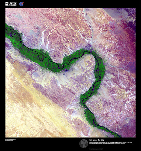 It is easy to see from this image why people have been drawn to the Nile River in Egypt for thousands of years. Green farmland marks a distinct boundary between the Nile floodplain and the surrounding harsh desert. 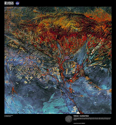 Bright red patches sprout from an agricultural landscape that looks almost like an abstract painting. The fields in this part of eastern Kazakhstan follow the contours of the land—long and narrow in mountain valleys, and large and rectangular over the plains. 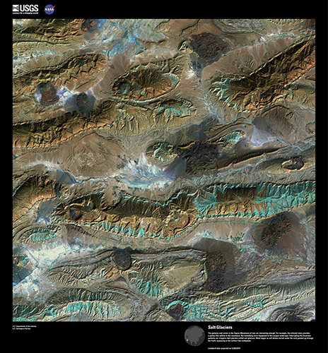 The Zagros Mountains of Iran are interesting enough. For example, the infrared view provides an outline to the mountains. But something more happened to this strange landscape. Interrupting the mountain patterns are irregular dark patches called salt glaciers. What began as salt domes buried under the rock pushed up through the Earth, squeezing to the surface like toothpaste. 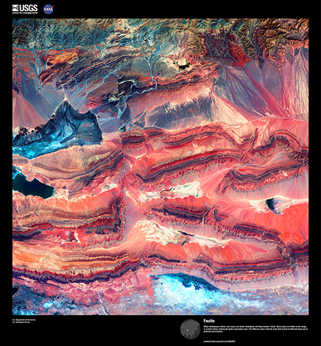 When landmasses collide, rock layers can break. Geologists call these breaks "faults." Rock layers are offset in this image in western China, making the faults remarkably clear. The different colors indicate rocks that formed at different times and in different environments. 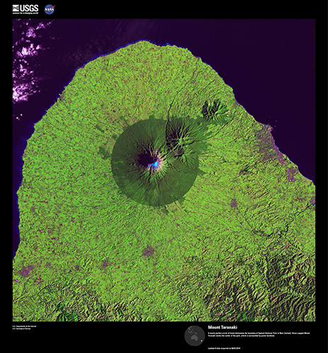 A nearly perfect circle of forest seperates the boundary of Egmont National Park in New Zealand. Snow-capped Mount Taranaki marks the center of the park, which is surrounded by green farmland. 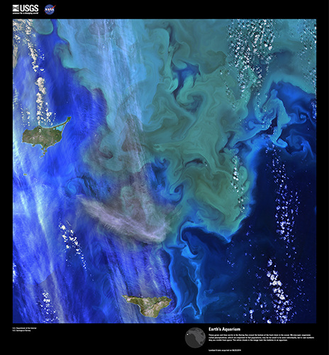 These green and blue swirls in the Bering Sea reveal the bottom of the food chain in the ocean. Microscopic organisms called phytoplankton, which are important to fish populations, may be too small to be seen alone, but in huge numbers they are visible from space. The white clouds in the image look like bubbles in an aquarium. 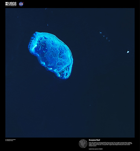 Is this a tiny creature on a microscope slide? No, but you are close. This is an image of a structure built by a multitude of small creatures. At about 13 miles wide, this feature is the largest coral structure in the southern Gulf of Mexico. The Arrecife Alacranes—or Scorpion Reef—supports a wide range of biological creatures and is home to several endangered species. 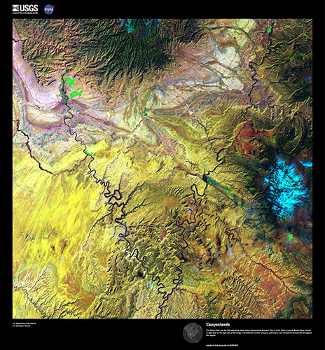 The Green River and the Colorado River meet within Canyonlands National Park in Utah. Snow-covered Mount Waas, shown in light blue on the right side of the image, overlooks the arches, canyons, and bizarre rock formations that can be found throughout this region 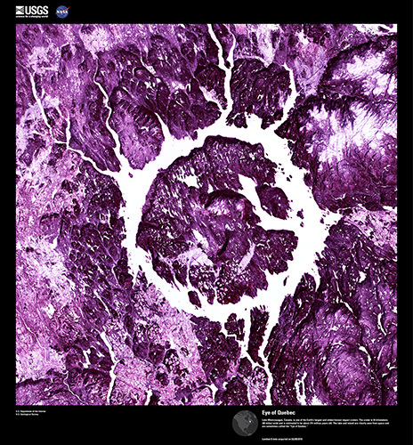 Lake Manicouagan, Canada, is one of the Earth's largest and oldest known impact craters. The crater is 40 miles wide and is estimated to be about 214 million years old! 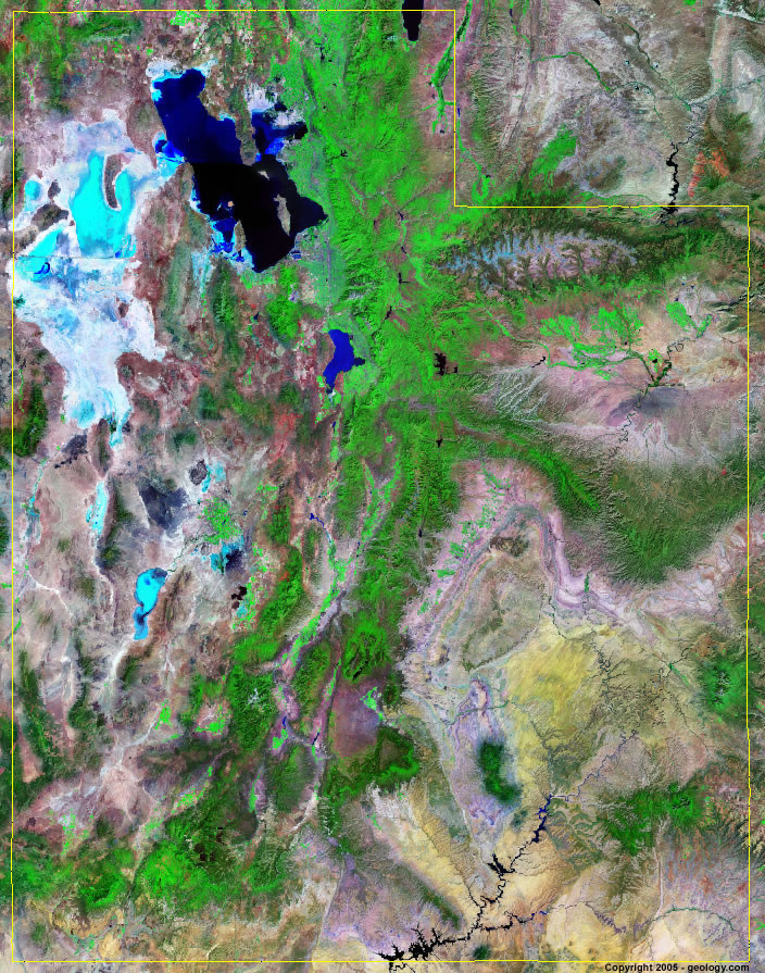 Alright, here's a little test...in this image of the state of Utah can you find where you live?
I hope this little slide show helped you feel like you were able to get out of "the house" for a little bit. Now back to what you were doing...t.v., video games, shopping, swimming, reading a good book, long boarding, kayaking, riding your bike, eating some watermelon, candy or hot dogs...
15 Comments
|
Mrs. TaylorI love science! Everything about the world is interesting and never boring. I love to study plants, animals, insects, and people. My favorite subjects are my students who are the most unique organisms on the planet! Categories |
 RSS Feed
